A Practical Guide to Revising a Peer-Reviewed Manuscript

Getting reviewer comments back can feel overwhelming—especially the first time. This article walks budding scientists through a clear, practical process for tackling peer-review revisions. From managing reviewer feedback to writing an effective response letter, this guide focuses on organization, momentum, and making it easy for reviewers to say yes.
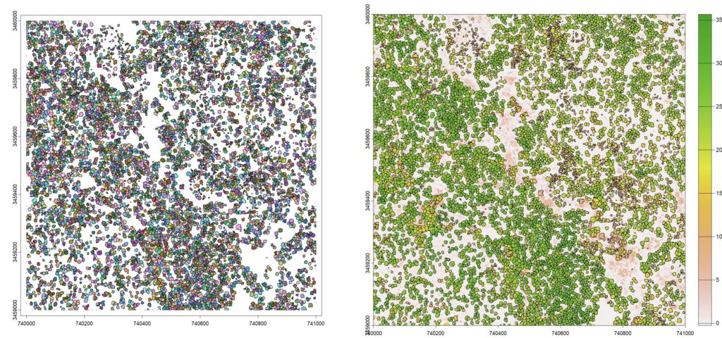
Extracting Stand Attributes from Aerial LiDAR Data
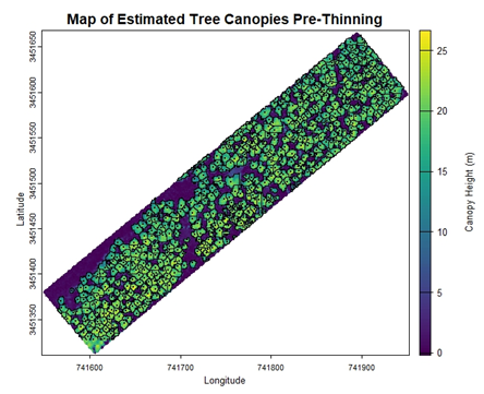
I was tasked with using aerial LiDAR to monitor changes in forest structure in a 30-year-old longleaf pine stand after thinning. After completing our lab’s online tutorials for getting started with LiDAR, I was able to develop an R script for estimating tree- and stand-level attributes. Follow along on this tutorial to see how simple remote sensing can be!
Webinar: Future directions for hurricane disturbed forests

This webinar features a panel of experts in silviculture, forest economics, management, and disturbance to discuss challenges and opportunties for resarch and outreach related to hurricane disturbaed forests.
Featured speakers include Dr. Christine Cairns Fortuin, Dr. Jeffery Cannon, Dr. Robert Chastain, Dr. Michael Crosby, Dr. Jesse Henderson, Dr. Bruno Kanieski da Silva, Dr. Adam Polinko, and Dr. Shaun Tanger.
Automatically Number Figures and Supplemental Material in Microsoft Word
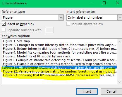
I learned to use Word’s built-in cross-referencing functions to streamling captioning figures and tables and referencing them in the text. But I could never find a guide that showed me how to use it for figures both in the main text and the supplemental materials. This guide shows you a trick I learned to number main text figures and supplmental figures separately!
Module 7: Putting it all together (large-scale raster products)
If you are interested in learning to use LiDAR for forestry and natural resources, this tutorial can help you get started. You will learn to create products for very large areas, deal with edge effects, and use parallel processing for fast analyses!
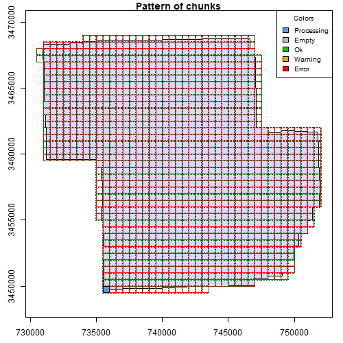
Module 6: Speed up your analyses: Parallel processing with LAScatalog

If you are interested in learning to use LiDAR for forestry and natural resources, this tutorial can help you get started. You will learn to work with large LiDAR datasets, set processing options, and learn how to deal with edge effects. These skills will help you analyze large areas seamlessly!
Module 5: Speeding up your analyses: Reduced datasets
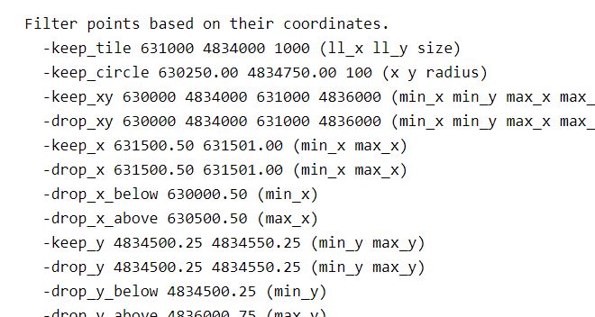
If you are interested in learning to use LiDAR for forestry and natural resources, this tutorial can help you get started. You will learn ways to help speed up and super charge your LiDAR analyses. This tutorial covers how to create spatial indexes for loading reduced datasets, subsetting to smaller scenes, and creating lower density point clouds.
Module 4: Putting it all together: Asking ecological questions
If you are interested in learning to use LiDAR for forestry and natural resources, this tutorial can help you get started. You will learn to extract data from lidar products like canopy size, tree locations, and elevation. You will also build a statistical model from lidar data to answer ecological questions
Module 3: Mapping trees from aerial LiDAR data
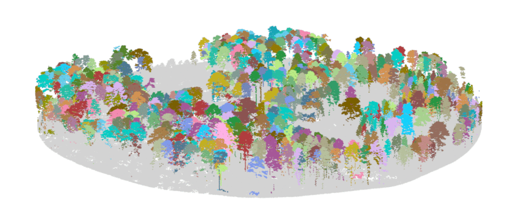
If you are interested in learning to use LiDAR for forestry and natural resources, this tutorial can help you identify tree locations, segment trees and estimate tree size, and turn a lidar point cloud into a stem map!
Module 2: Creating raster products from point clouds

If you are interested in learning to use LiDAR for forestry and natural resources, this tutorial can help you get started. You will learn to create raster products like digital elevation models and canopy height models. The tutorial also covers how to make your own custom functions to analyze LIDAR data.