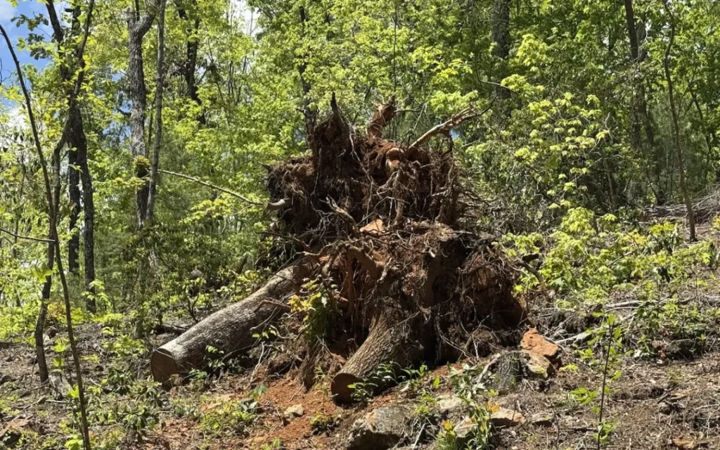
New Study: 48 Wildlife species use uprooted longleaf pine root mounds
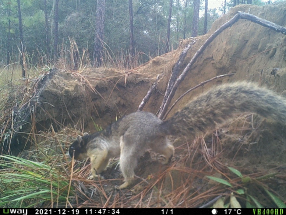
We partnered with the Herpetology lab in a new study which showed that uprooted longleaf pine tip-ups—created when trees fall—provide a brief but critical wildlife habitat. Using >1 million camera-trap photos, we documented 48 vertebrate species using the mounds to forage, perch, bask, or shelter. The study highlights how even short-lived storm features support biodiversity and should factor into post-disturbance management decisions.
Sierra Magazine highlights forest impacts from Helene and lab’s ongoing research on forest resilience
A new Sierra article explores the long-term impacts of Hurricane Helene on Western North Carolina’s forests, including tree loss, fire risk, and shifting species composition. Our lab contributed insight into how storm damage affects forest resilience and recovery. Understanding these dynamics is key to guiding restoration efforts and preparing for more frequent, intense storms in the region.
New video highlights lab’s research on water benefits from longleaf pine restoration
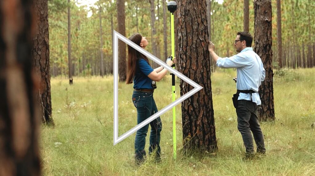
Research from the Landscape Ecology and Ecohydrology labs shows shows that restoring open longleaf pine woodlands can boost streamflow—especially during drought. Watersheds with more longleaf cover had up to 92% higher flows in dry years, making this iconic ecosystem a potential ally in the fight against water scarcity. Watch the short video to see how climate-smart forest management can help sustain both forests and freshwater.
Now hiring: Mussel Conservation & Landscape Ecology Seasonal Technician

We are seeking applicants from motivated individuals for a Seasonal Research Technican to contribute to the development of a Habitat Conservation Plan for freshwater mussels. The successful applicant will assist with UAV stream surveys, use acoustic doppler on stream reaches, and conduct biological surveys for freshwater mussels. The position will work in a team setting, collaborating with the Jones Center Mussel Conservation and Landscape Ecology Research Teams. Applications reviewed immediately
Module 7: Putting it all together (large-scale raster products)
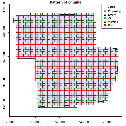
If you are interested in learning to use LiDAR for forestry and natural resources, this tutorial can help you get started. You will learn to create products for very large areas, deal with edge effects, and use parallel processing for fast analyses!
Module 6: Speed up your analyses: Parallel processing with LAScatalog

If you are interested in learning to use LiDAR for forestry and natural resources, this tutorial can help you get started. You will learn to work with large LiDAR datasets, set processing options, and learn how to deal with edge effects. These skills will help you analyze large areas seamlessly!
Module 5: Speeding up your analyses: Reduced datasets
If you are interested in learning to use LiDAR for forestry and natural resources, this tutorial can help you get started. You will learn ways to help speed up and super charge your LiDAR analyses. This tutorial covers how to create spatial indexes for loading reduced datasets, subsetting to smaller scenes, and creating lower density point clouds.
Module 4: Putting it all together: Asking ecological questions
If you are interested in learning to use LiDAR for forestry and natural resources, this tutorial can help you get started. You will learn to extract data from lidar products like canopy size, tree locations, and elevation. You will also build a statistical model from lidar data to answer ecological questions
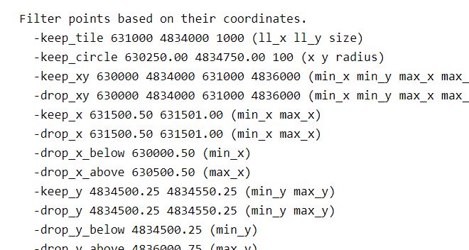
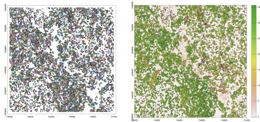
Module 3: Mapping trees from aerial LiDAR data
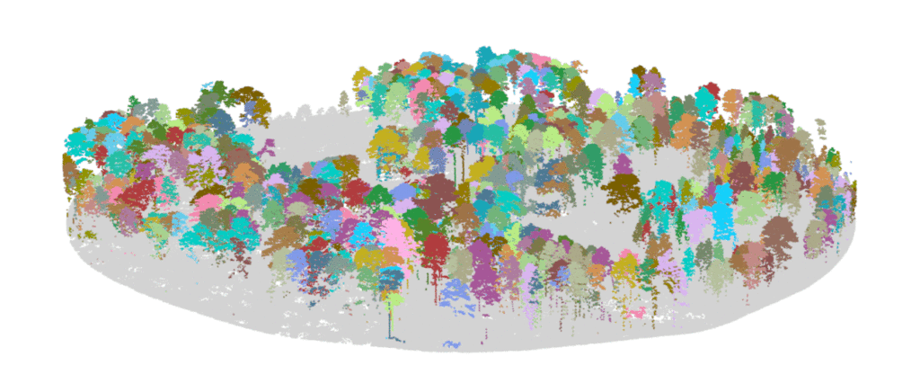
If you are interested in learning to use LiDAR for forestry and natural resources, this tutorial can help you identify tree locations, segment trees and estimate tree size, and turn a lidar point cloud into a stem map!
Module 2: Creating raster products from point clouds

If you are interested in learning to use LiDAR for forestry and natural resources, this tutorial can help you get started. You will learn to create raster products like digital elevation models and canopy height models. The tutorial also covers how to make your own custom functions to analyze LIDAR data.