Podcast: Hurricanes and Forest Ecology | Timber University Podcast, Ep. 41
Recently Dr. Jeffery Cannon joined the Timber University podcast to discuss the lab’s hurricane research in longleaf pine ecosystems. The conversation covers how storms shape forest structure, stimulate reproduction, and reinforce fire regimes — and how lidar is helping researchers quantify these impacts. The episode also touches on managing for resilience and what disturbance ecology means for landowners and restoration practitioners.
New Study: Modeling smoke exposure from burn permits
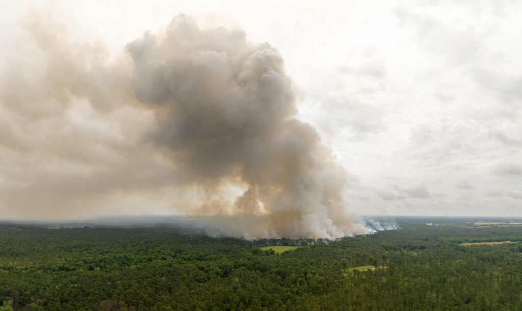
Prescribed fire is essential for forest management, but estimating its smoke impacts remains a challenge. Our lab contributed to a new study creating a novel way of estimating smoke exposure from burn permit geodatabases by integrating them with atmospheric and chemical transport models to improve PM2.5 estimates from Rx burns. The permit-based approach captures small, short-lived burns often missed by satellites and allows exploring new ways to reduce smoke emissions overall
“Piloting” metrics for monitoring biodiversity credits

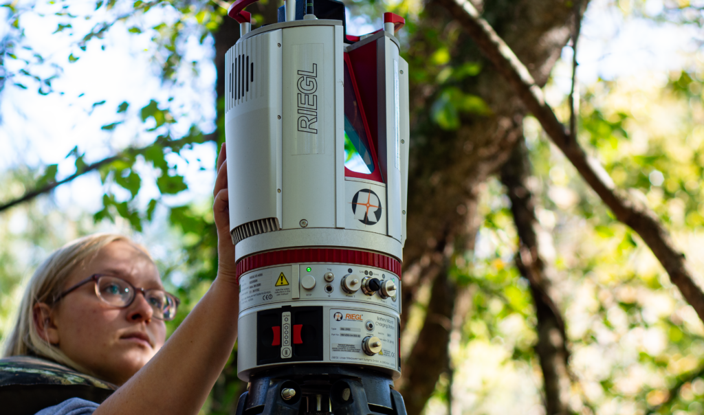
The first U.S. biodiversity credits were sold in May 2025 for longleaf pine restoration, signaling a new market to support conservation. The Landscape Ecology Lab is pioneering streamlined monitoring protocols using drones and terrestrial lidar to measure vegetation structure in longleaf ecosystems. This cost-effective approach could make biodiversity credits more accessible to small landowners and provide viable financial incentives for conservation work.
New Study: Spaceborne lidar advances global forest monitoring
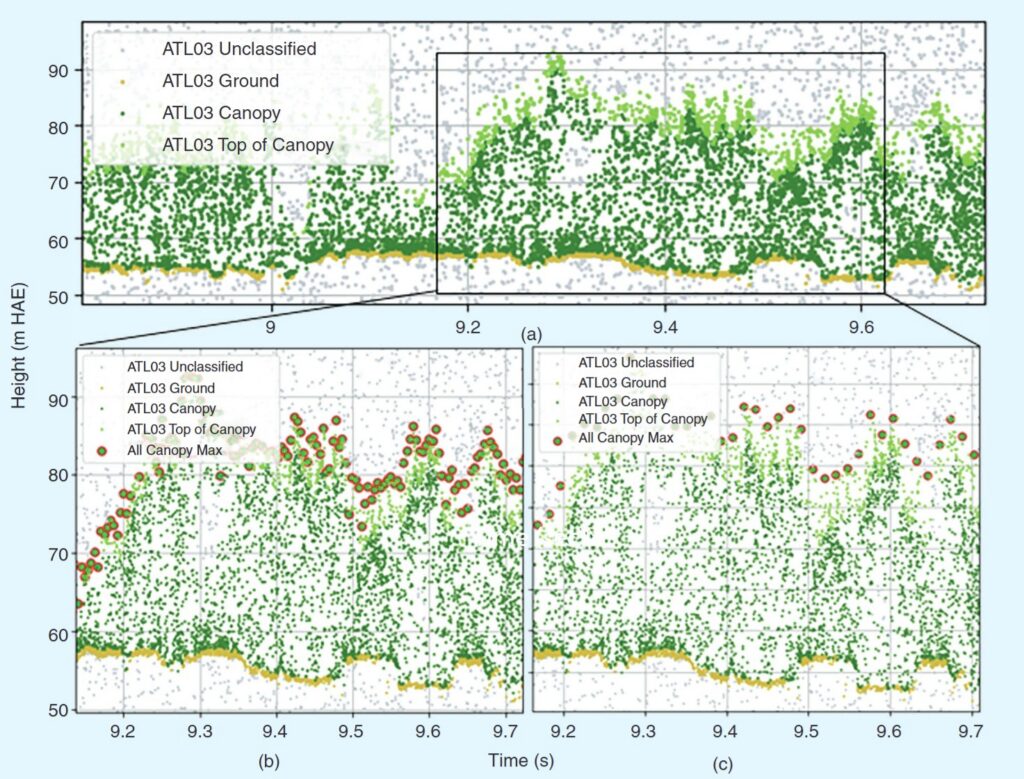
The Jones Center Landscape Ecology lab joined a global research team to synthesize research on NASA’s ICESat-2 spaceborne lidar mission and its applications for forest vegetation monitoring beyond its initial mission for ice monitoring. The team analyzed 293 studies and identified both current uses and emerging opportunities for combining satellite data to better understand forests, fire ecology, and environmental change.
Now hiring: Landscape Ecology Seasonal Technician
We are seeking motivated individuals to apply for a Seasonal Technician position to contribute to research on restoration and hurricane ecology of longleaf pine woodlands. The successful applicant will assist with field data collection on forest restoration research, and collection and processing of terretrial lidar data. The position will work in a team setting with staff of the Landscape Ecology lab at the Jones Center at Ichauway. Applications reviewed immediately.
Extracting Stand Attributes from Aerial LiDAR Data
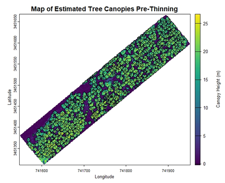
I was tasked with using aerial LiDAR to monitor changes in forest structure in a 30-year-old longleaf pine stand after thinning. After completing our lab’s online tutorials for getting started with LiDAR, I was able to develop an R script for estimating tree- and stand-level attributes. Follow along on this tutorial to see how simple remote sensing can be!
Now hiring: Landscape Ecology Geospatial Analyst

We are seeking motivated individuals to apply for a Geospatial Analyst position to contribute to research and development that will improve forest conservation efforts in the southeastern US. Both remote and in-person candidates will be considered. The successful applicant will integrate cutting edge technologies (UAV and lidar), field experiments, and data science techniques to contribute to collaborations with conservation agencies and research partners. The position will work in a team setting with staff of the Landscape Ecology lab at the Jones Center at Ichauway. Applications reviewed immediately.
Webinar: Future directions for hurricane disturbed forests

This webinar features a panel of experts in silviculture, forest economics, management, and disturbance to discuss challenges and opportunties for resarch and outreach related to hurricane disturbaed forests.
Featured speakers include Dr. Christine Cairns Fortuin, Dr. Jeffery Cannon, Dr. Robert Chastain, Dr. Michael Crosby, Dr. Jesse Henderson, Dr. Bruno Kanieski da Silva, Dr. Adam Polinko, and Dr. Shaun Tanger.
Now hiring: Mussel Conservation & Landscape Ecology Seasonal Technician

We are seeking applicants from motivated individuals for a Seasonal Research Technican to contribute to the development of a Habitat Conservation Plan for freshwater mussels. The successful applicant will assist with UAV stream surveys, use acoustic doppler on stream reaches, and conduct biological surveys for freshwater mussels. The position will work in a team setting, collaborating with the Jones Center Mussel Conservation and Landscape Ecology Research Teams. Applications reviewed immediately
Module 7: Putting it all together (large-scale raster products)
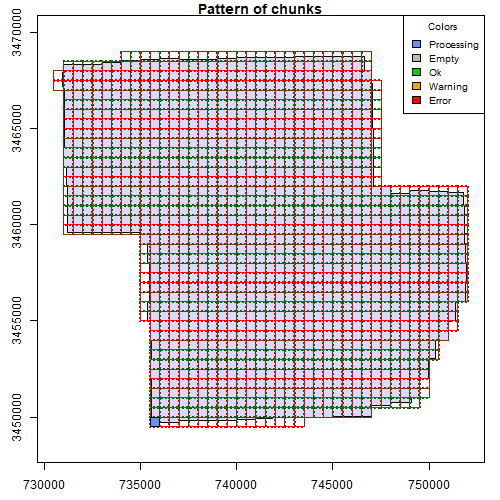
If you are interested in learning to use LiDAR for forestry and natural resources, this tutorial can help you get started. You will learn to create products for very large areas, deal with edge effects, and use parallel processing for fast analyses!