Module 5: Speeding up your analyses: Reduced datasets
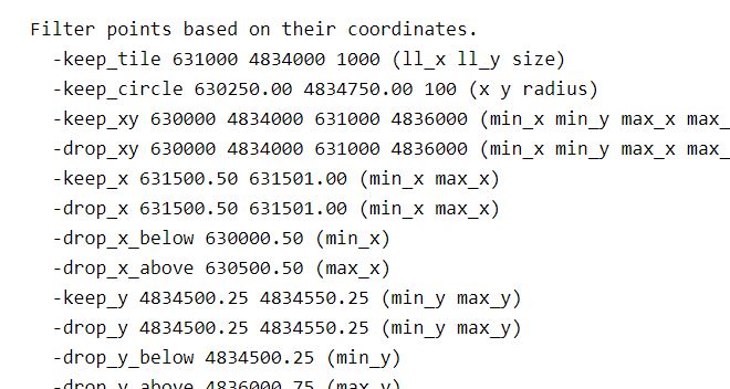
If you are interested in learning to use LiDAR for forestry and natural resources, this tutorial can help you get started. You will learn ways to help speed up and super charge your LiDAR analyses. This tutorial covers how to create spatial indexes for loading reduced datasets, subsetting to smaller scenes, and creating lower density point clouds.