Extracting Stand Attributes from Aerial LiDAR Data
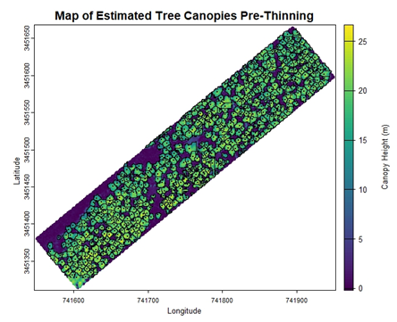
I was tasked with using aerial LiDAR to monitor changes in forest structure in a 30-year-old longleaf pine stand after thinning. After completing our lab’s online tutorials for getting started with LiDAR, I was able to develop an R script for estimating tree- and stand-level attributes. Follow along on this tutorial to see how simple remote sensing can be!